Maps Page on Guatemala/Central
America
Outline
- Physical Environment
- First map name
- Second map name
- Third map name
- Weather & Climate
- First map name
- Second map name
- Third map name
- Human Environment
- First map name
- Second map name
- Third map name
- Road maps
- First map name
- Second map name
- Third map name
- City Maps
- First map name
- Second map name
- Third map name
- Urban Transportation Maps
- First map name
- Second map name
- Third map name
- Tourist Maps
- First map name
- Second map name
- Third map name
1 Physical
Environment
(Map 1)
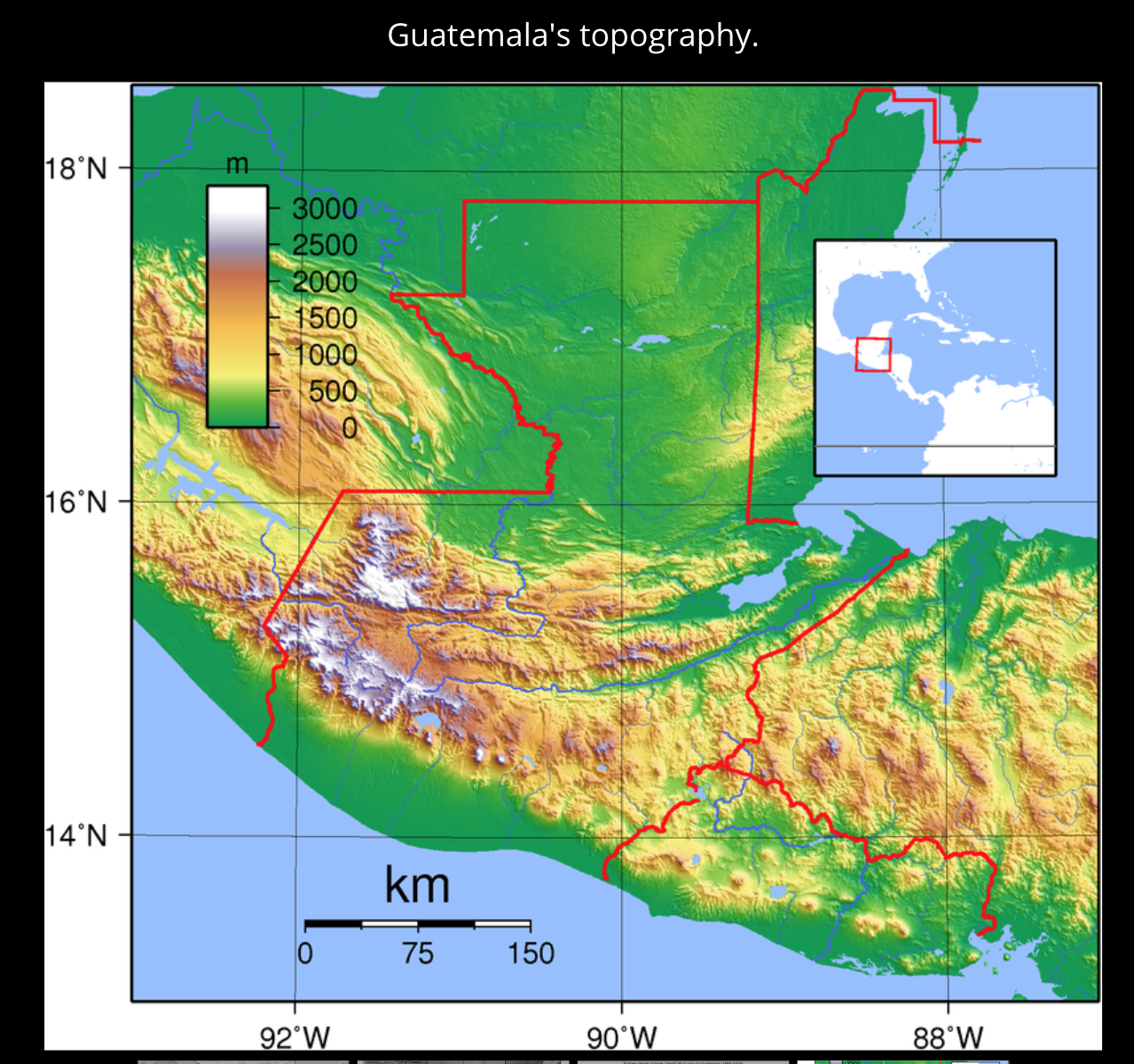
The image above shows us a topography map of Guatemala. This shows us the physical landscape of Guatemala allowing us to see prominent geographical features.
(Map 2)
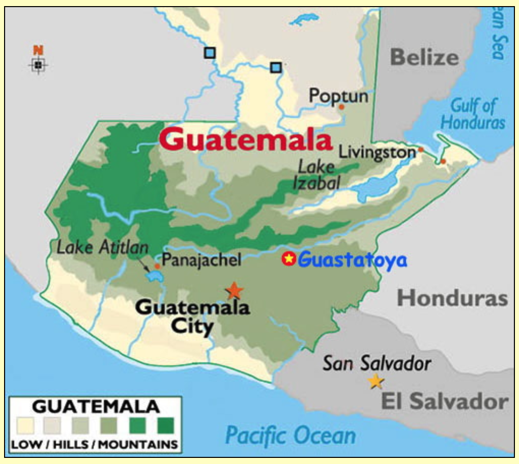
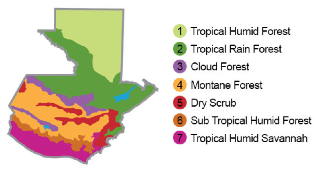
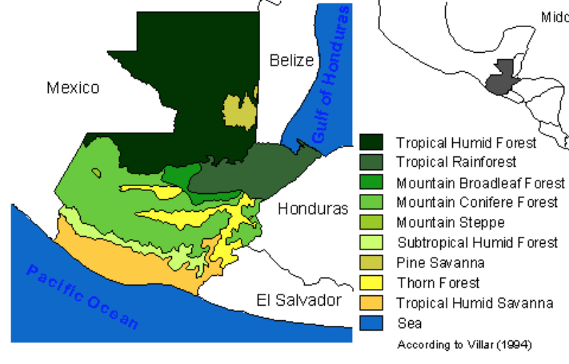
The image above shows the different terrains across Guatemala. This shows us what physical obstacles you may come across while traveling through Guatemala.
(Map 3)
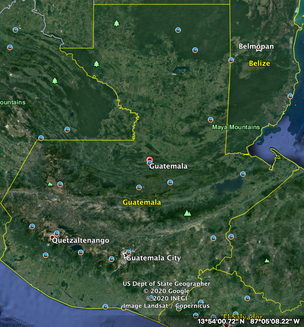
The image above shows a satellite view of Guatemala. This allows us to see they physical geography of Guatemala in a more realistic sense.
2 Weather &
Climate
(Map 1)
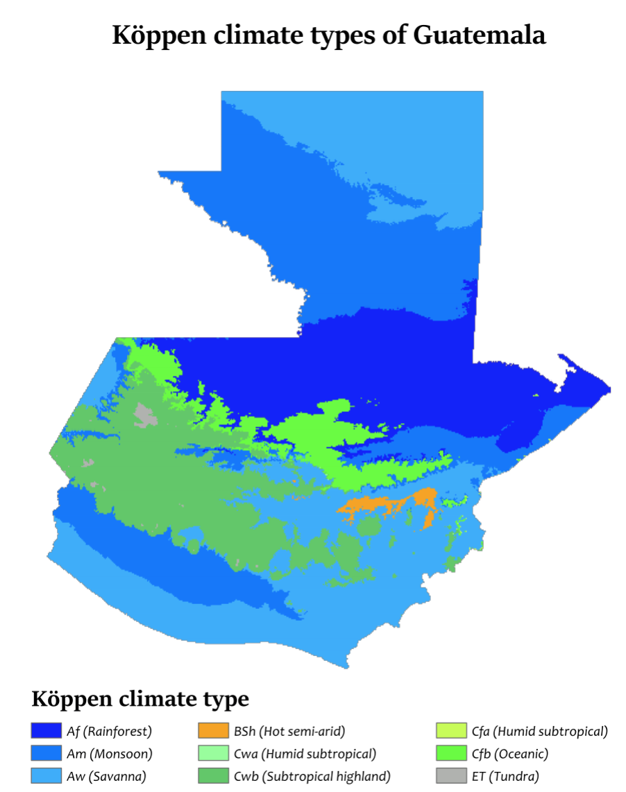
Above is a map showing us the different climate zones of Guatemala based on the Koppen climate classification system.
(Map 2)
Above is a climate map of Guatemala showing us the different climate regions across the country.
(Map 3)
Above is a climate map which allows us to see the differences in climates across Guatemala. This will help understand what weather to pack for when traveling the different regions.
3 Human Environment
(Map 1)
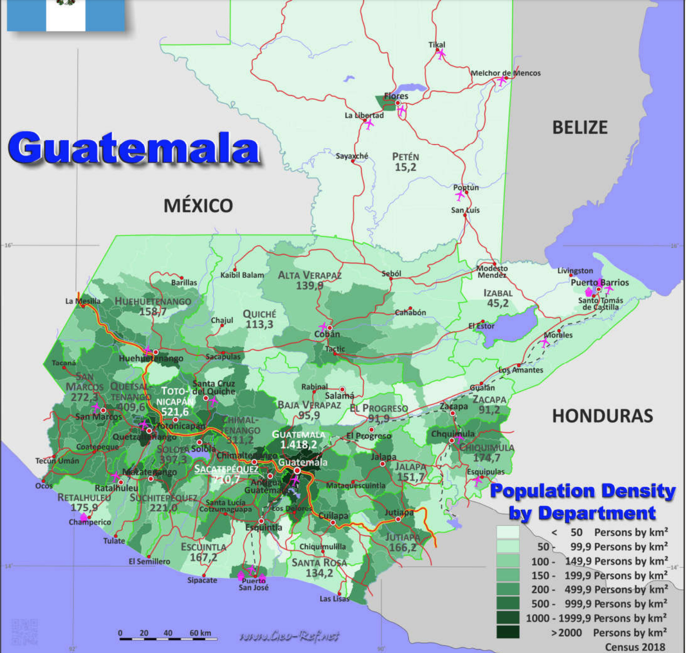
Above is a population density map of Guatemala based on the 2018 Census.
(Map 2)
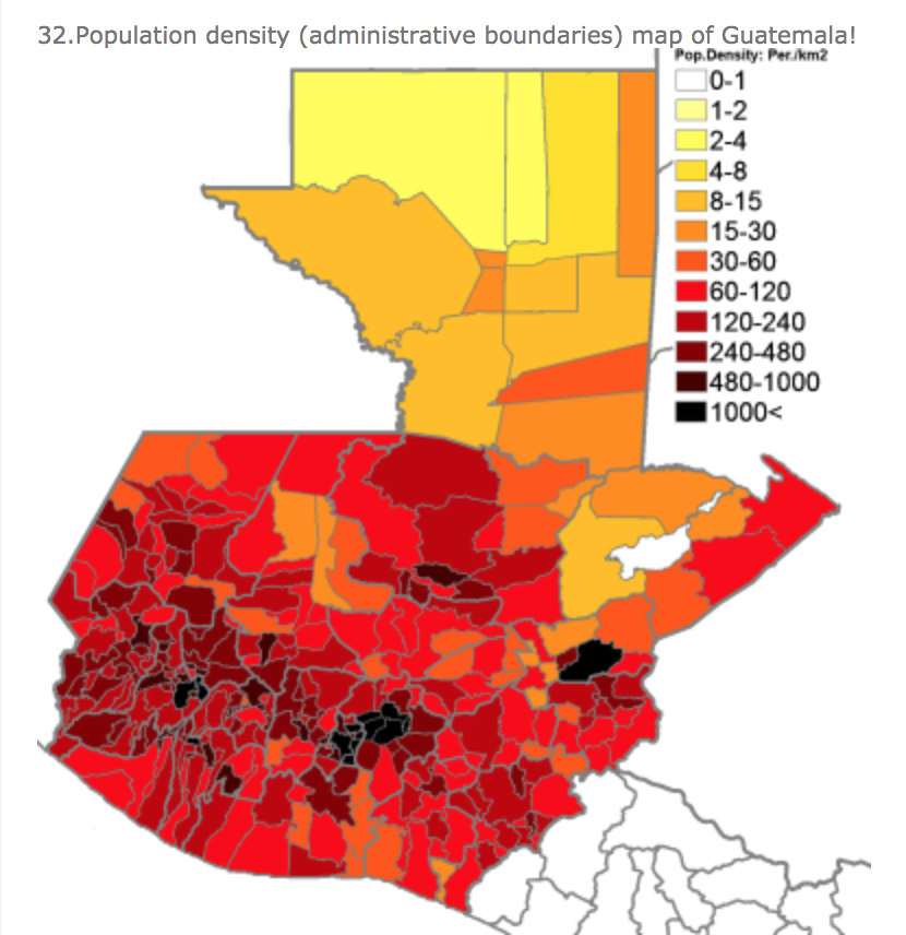
Above is a population density map of Guatemala per/ km2. This shows which regions are heavily populated and possible cultural hubs.
(Map 3)
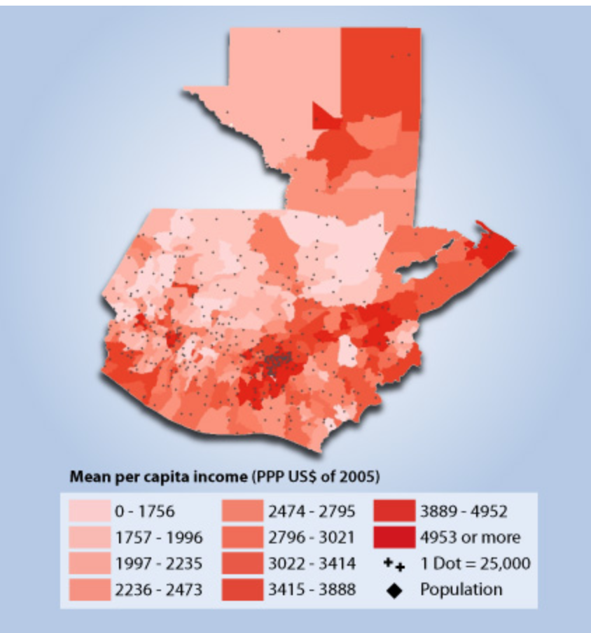
The map above shows the mean per capita income in Guatemala in U.S dollars. This shows us the wealth distribution across the country and potentially cheaper areas to visit/stay.
4 Road Maps
(Map 1)
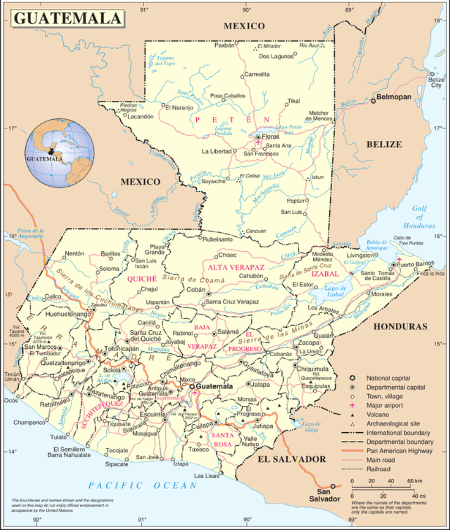
The map above shows us all of the major road systems running through Guatemala.
(Map 2)
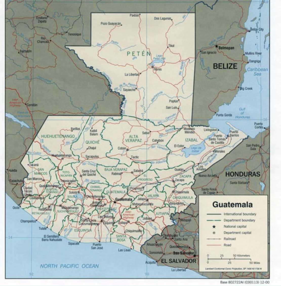
The map above is a road map of Guatemala showing the dominate roadways of the country. This map is important because most of these roadways connect to neighboring countries.
(Map 3)
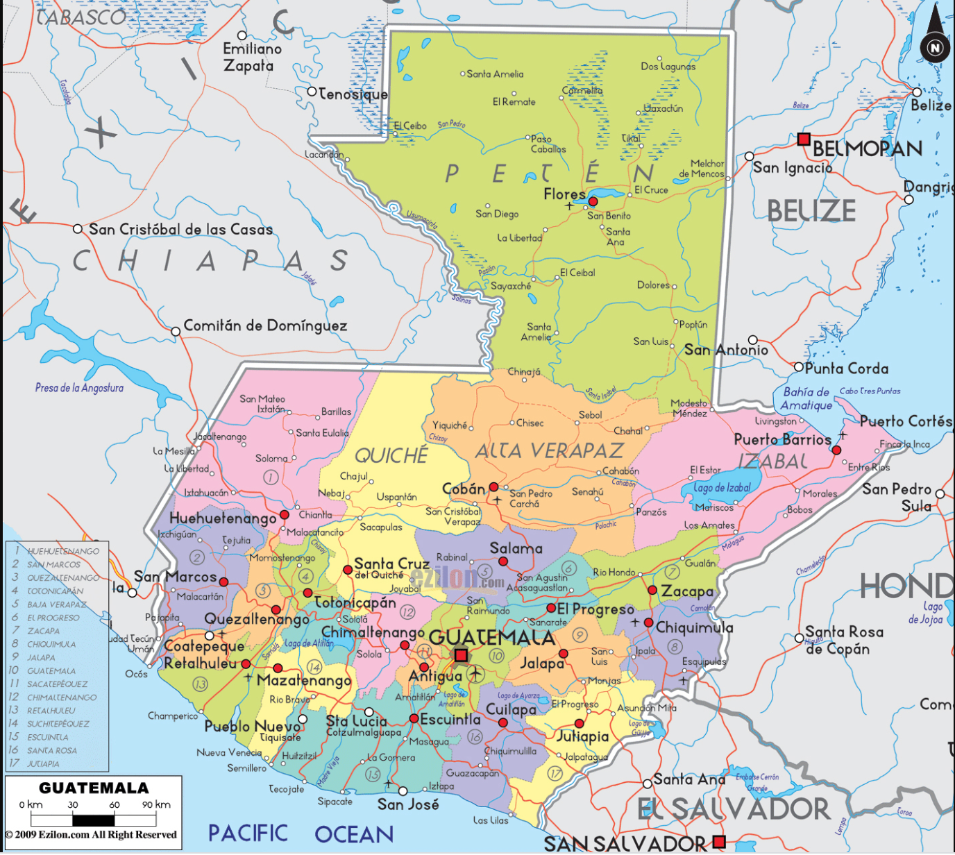
The map above gives us a detailed view of major roadways in Guatemala and potential stops along theses major roadways.
5 City Maps
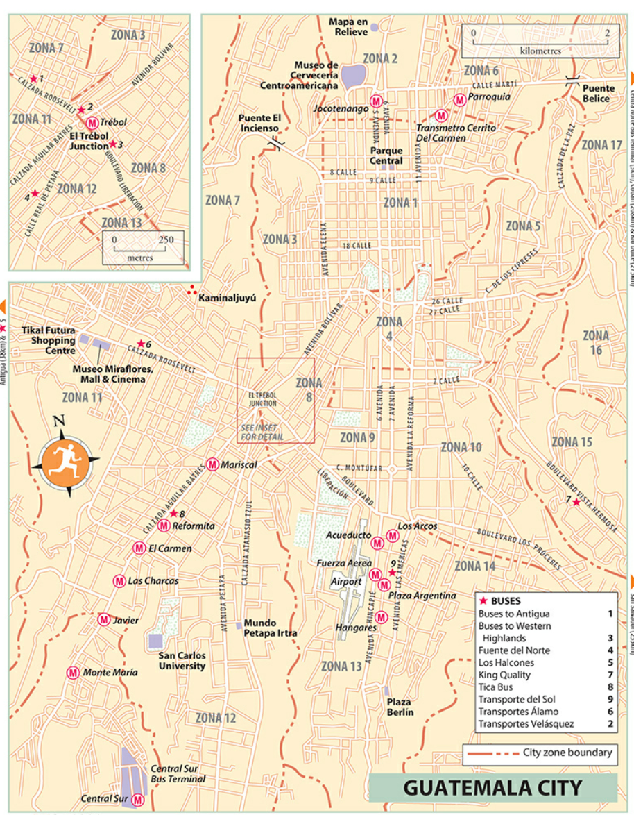
(Map 1)
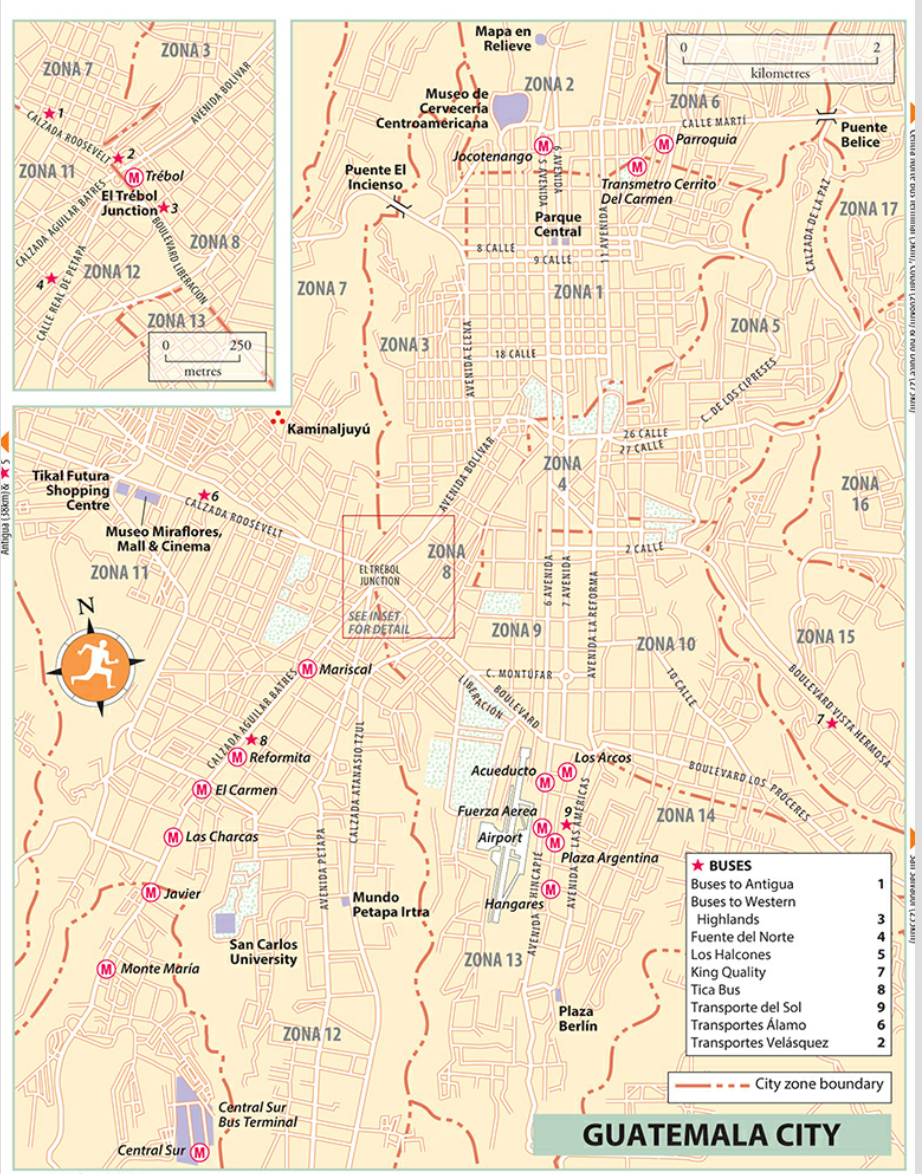
Above is a map of Guatemala City. This map is important because it shows major roadways and bus stops in the city.
(Map 2)
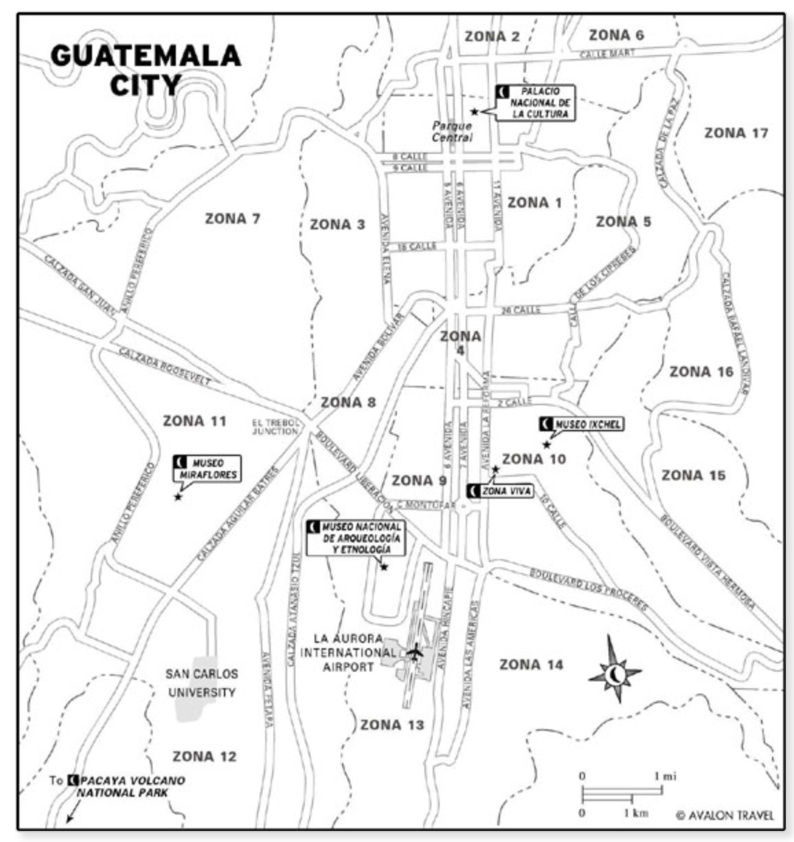
The map above shows the major road systems in Guatemala City.
(Map 3)
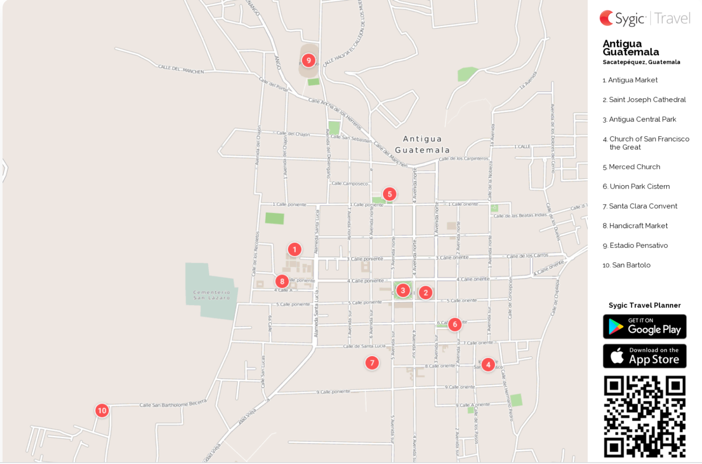
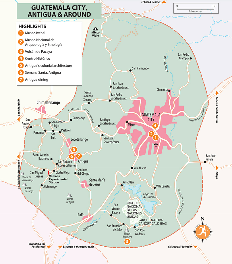
The map above shows the major roads in the city of Antigua. Antigua is located in the southern portion of Guatemala.
6 Urban
Transportation
(Map 1)
This map shows us all of the major bus stops in Guatemala City. This is important because bus is the main mode of transportation.
(Map 2)
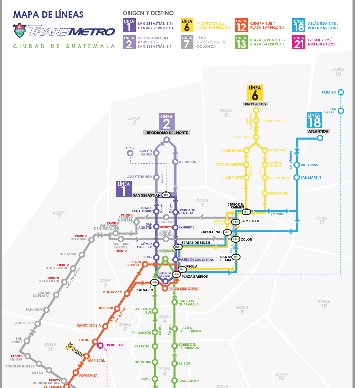
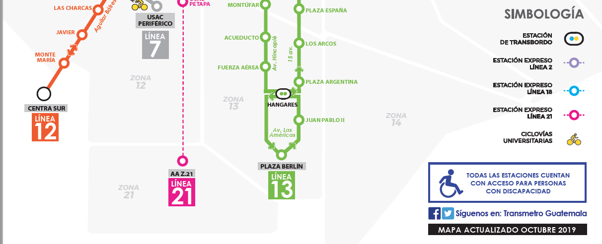
This is a map from Trans-metro showing all of the major bus routes their busses take through Guatemala City.
(Map 3)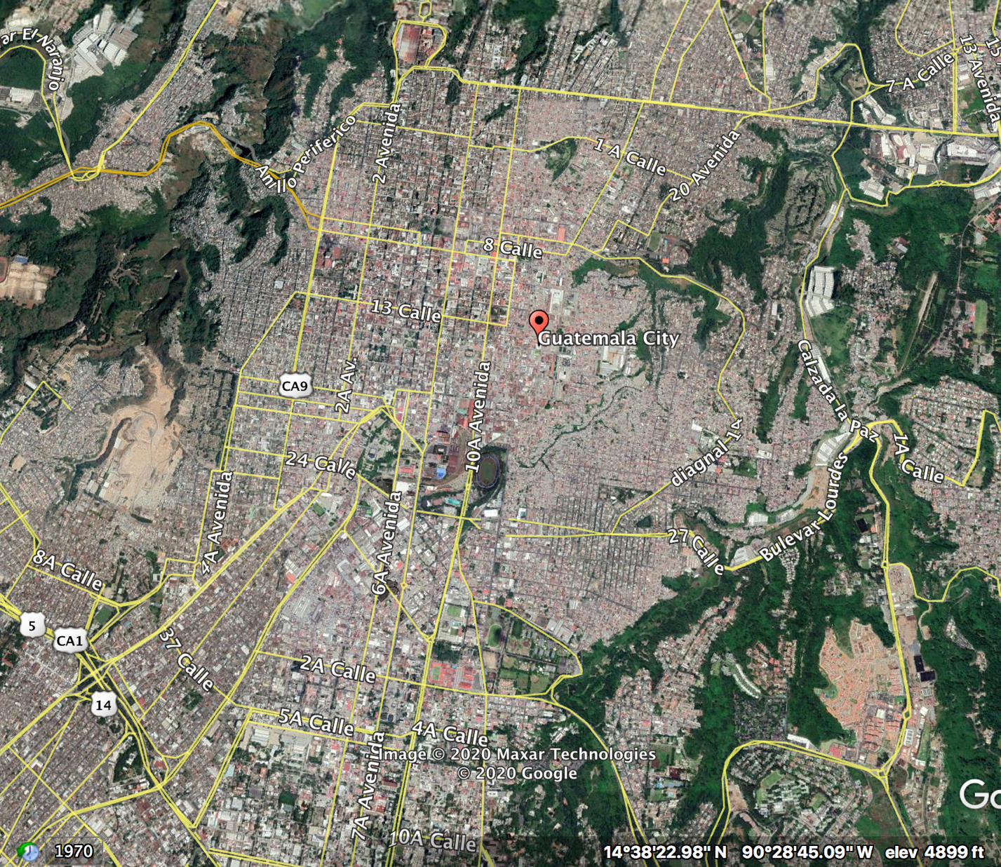
The map above shows us a realistic view of Guatemala City while showing us the major roadways and names.
7 Tourist Sites
(Map 1)
The map above shows us where we can visit volcanic cites around Guatemala City.
(Map 2)
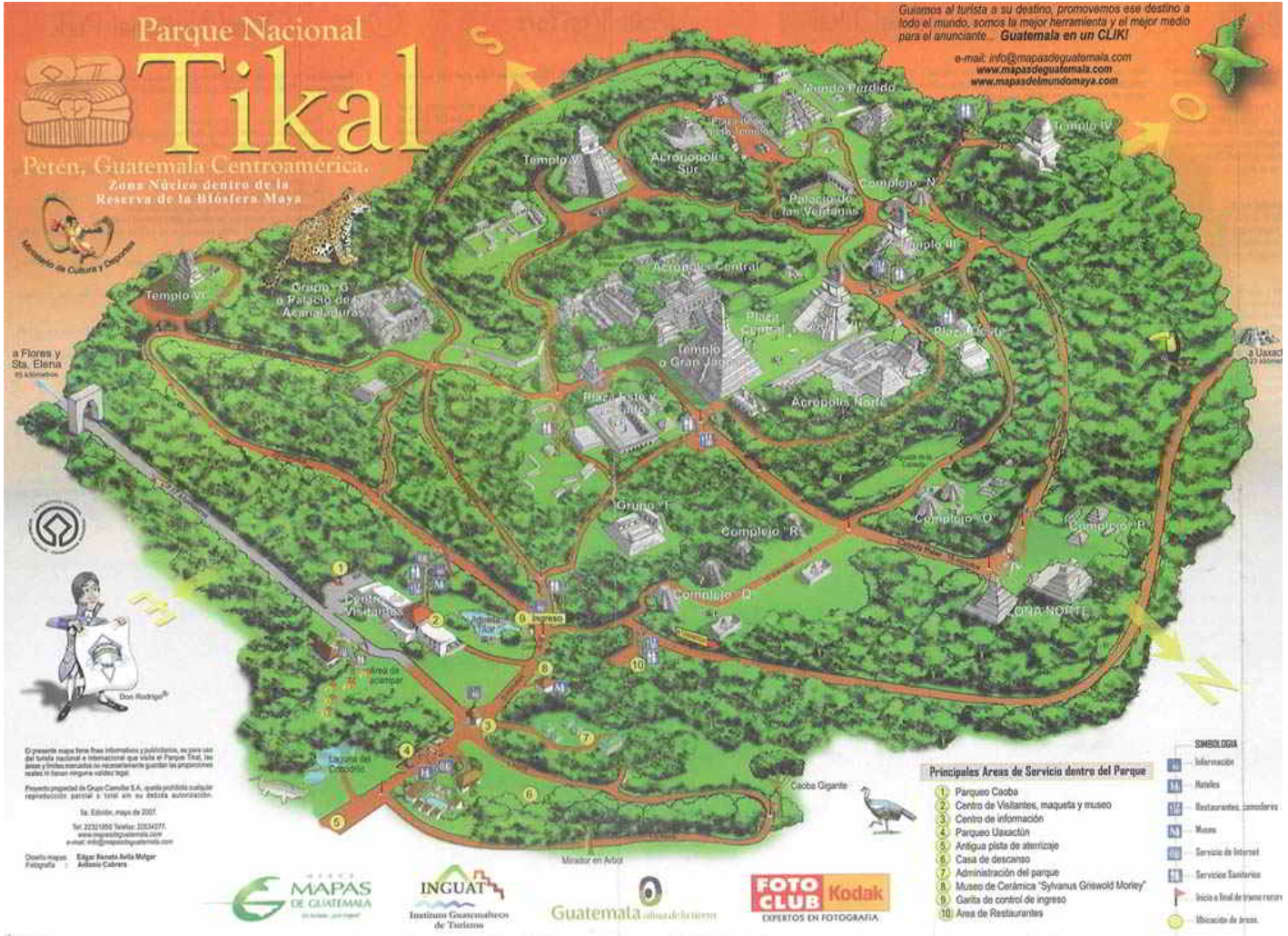
This is a map for Tikal National Park, an ancient Mayan city and one of the most famous locations in Guatemala.
(Map 3)
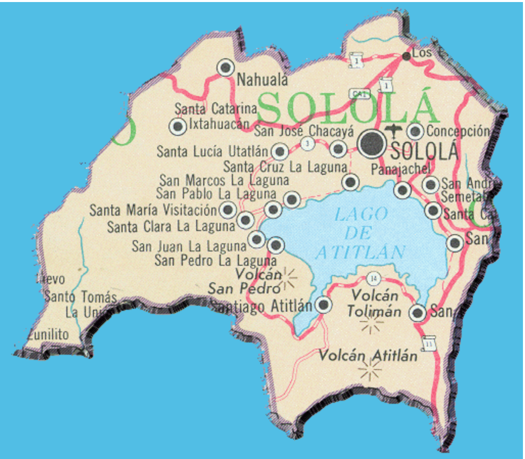
The map above shows us Atitlan Lake and the surrounding region. Atitlan Lake is a large lake which is bordered by volcanic activity.
Submitted
by [Zach Boll] on [3/6/2020].