Image Page on
Guatemala/Central America
Outline
- Landscapes
- San Francisco Church in
Antigua
- El Paredon
- Rio Cahabon
- Lake Atitlan
- Cities
- Guatemala City
- San Marcos
- Huehuetenango
- Coban
- Landmarks
- Tikal National Park
- Antigua
- Pacaya Volcano
- Quetzaltenango
- Images of People
- Mayan Family from
Yucatan
- Elena Bizarro
- Sustenance
Farmer-Alotenango
- Antigua Market
- Images from the book
- Todos Santos Cuchumatan
- Second image of
something pictured in the book
6.
Webcam
Guatemala City -Airport
7.
Panorama
Lake Atitlan
1 Landscapes
1) San
Francisco Church-Antigua 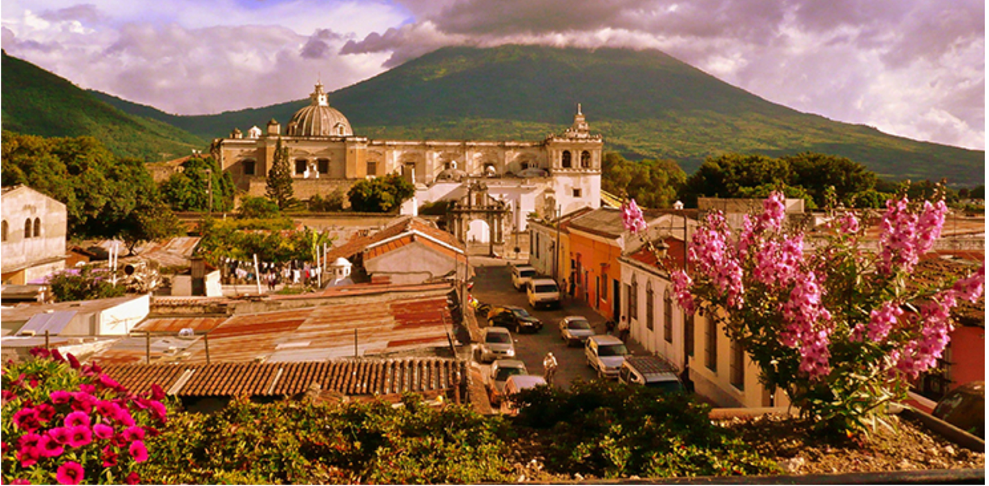
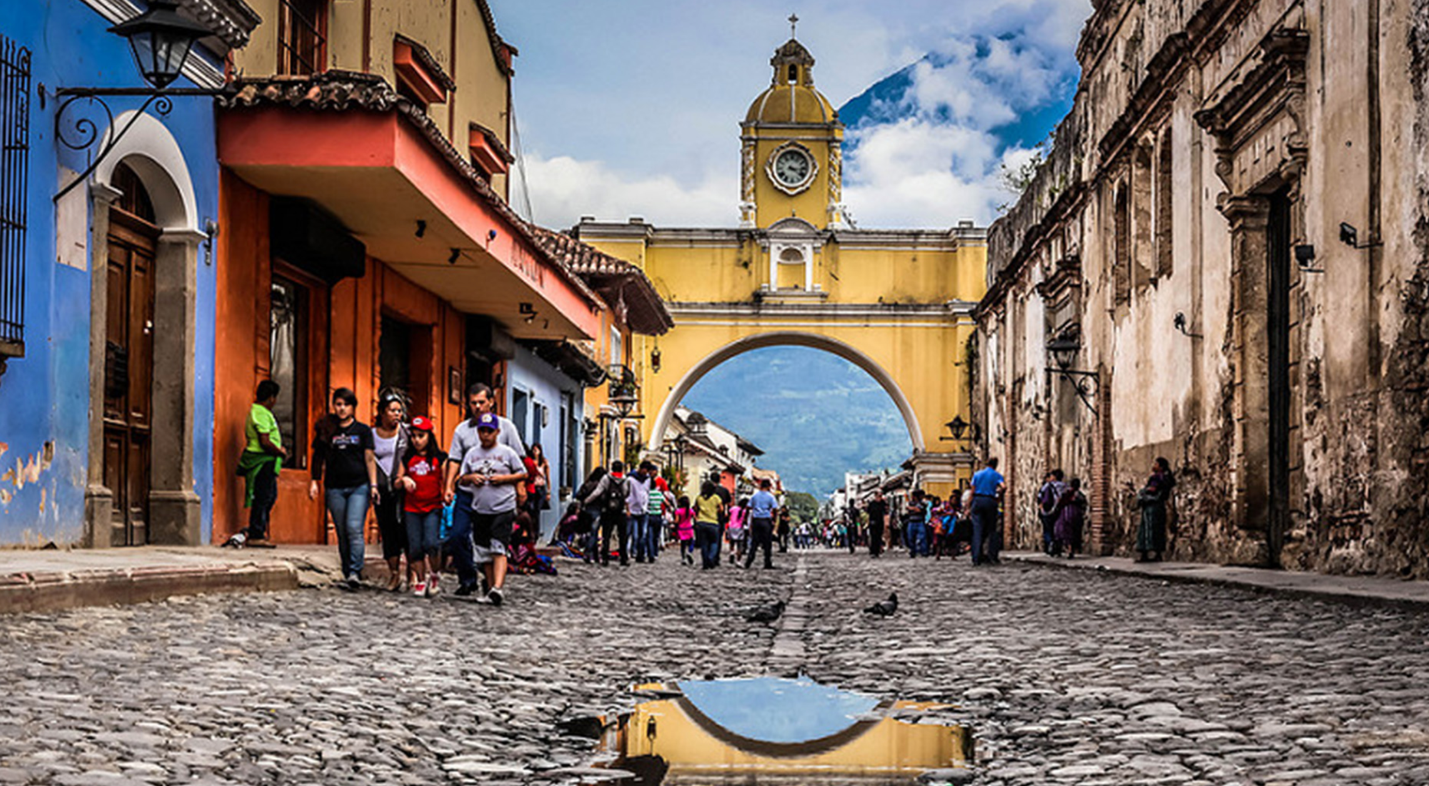
Antigua is one of the most well-known tourist attractions in Guatemala due to its beautiful landscapes and Volcanoes as seen in the image of San Francisco Church. Antigua is filled with street vendors and roadside eateries which are located outside of local boutiques throughout the city. Antigua is located in the central highlands of Guatemala and is widely known for its well preserved Spanish Baroque-influenced architecture. Antigua has a warm-temperate climate and experiences dry winters and wet summers making the winter months preferable for travel.
2) El
Paredon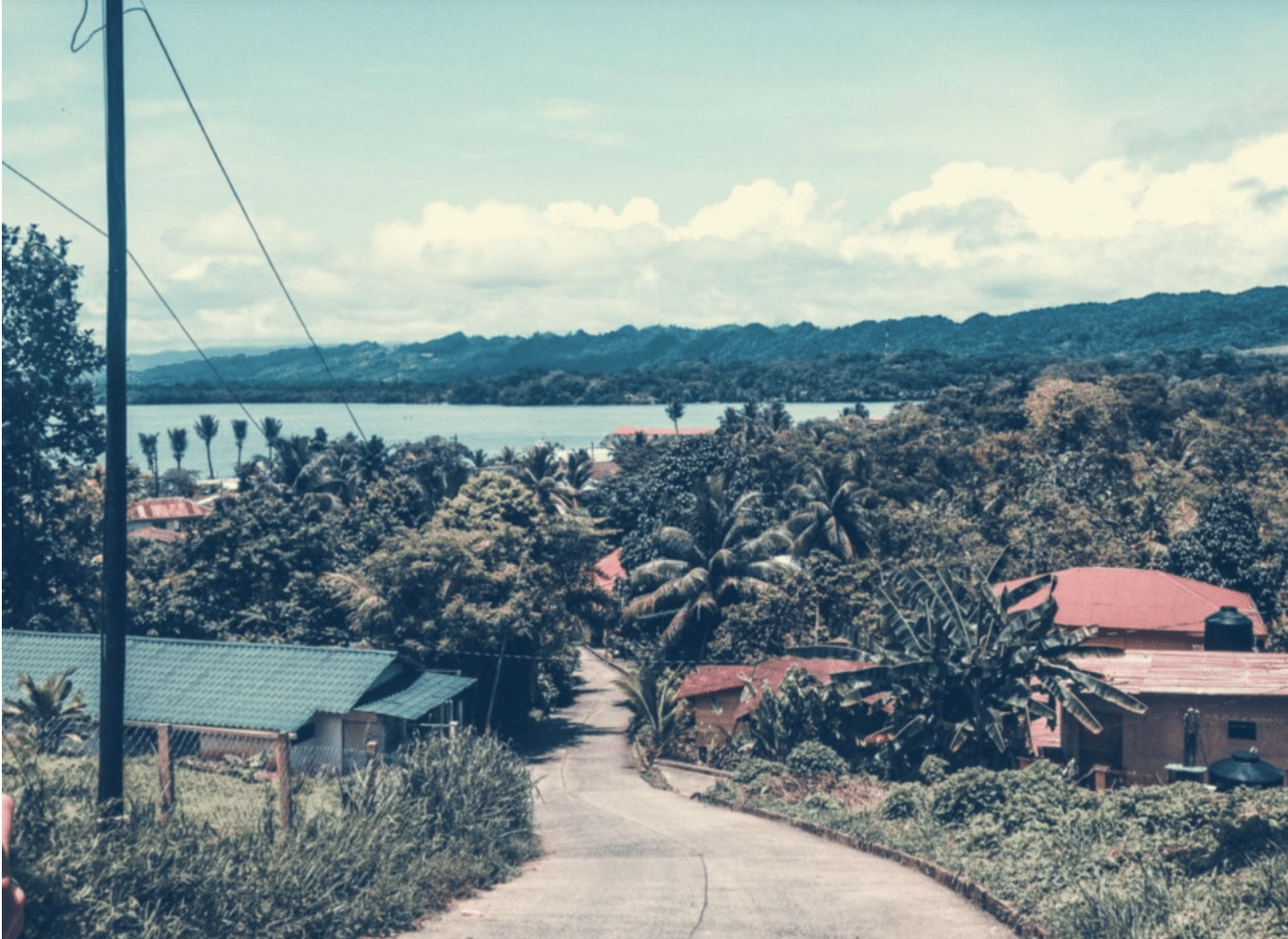
It is Easy to see why El Paredon is known as one of the best beaches to visit in Guatemala. This beach is so popular due to the ability to submerge yourself into the culture surrounding the El Paredon village which is heavily influenced by surfing. People from all over the world visit this destination because the wave breaks in this location are unique. El Paredon is a great way to experience one of the many different cultural environments Guatemala has to offer.
3) Rio
Cahabon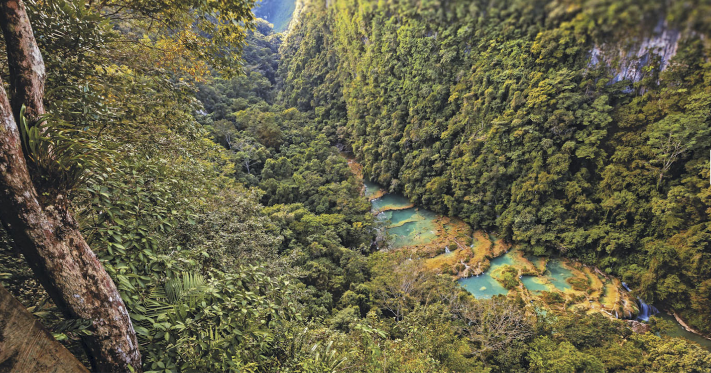
The Rio Cahabon is a 196-kilometre long river in the Eastern portion of Guatemala. The Rio Cahbon rips its way through heavily wooded areas surrounded by steep cliffs and large boulders. The white waters this river produces makes it an excellent spot to go white water rafting. The river is able to produce rapids large enough for rafting year round which makes it a great place to visit any time of the year. This area demonstrates how diverse the Guatemalan landscape can be in comparison to the beaches of El Paredon.
4) Lake
Atitlan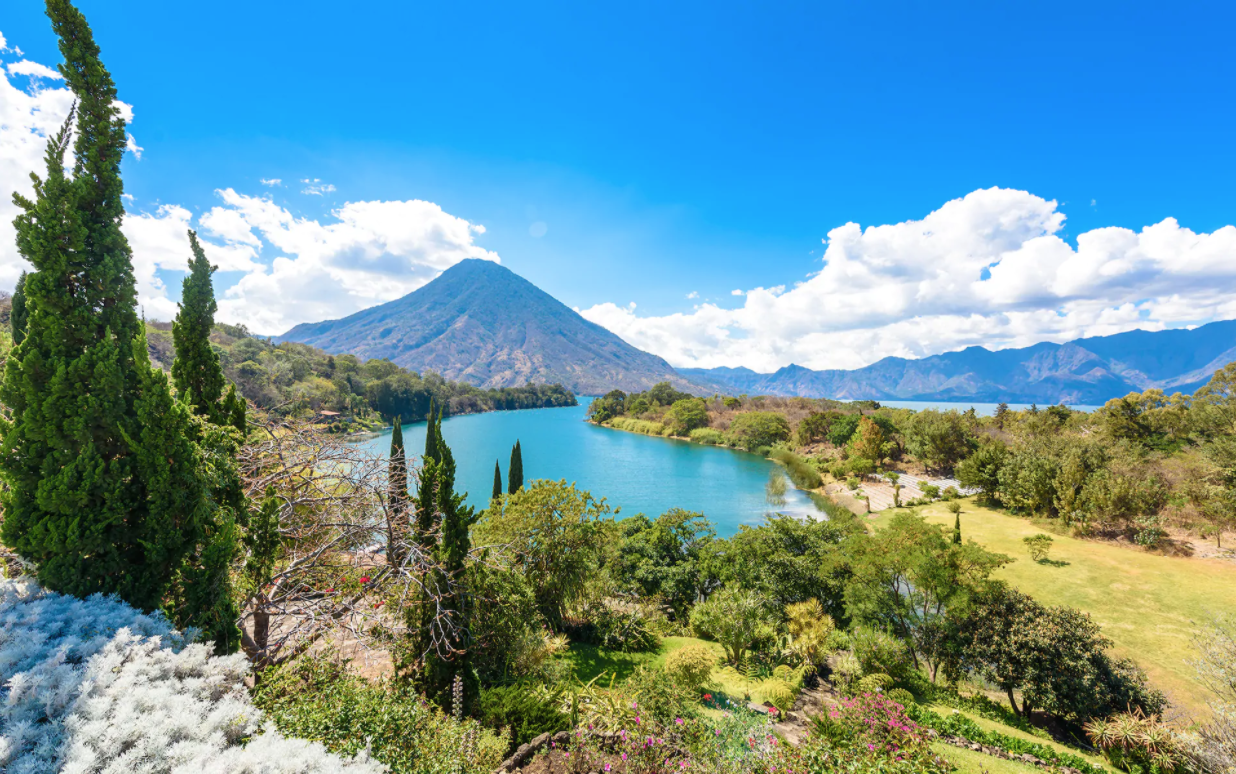
Lake Atitlan is a very attractive region in the central highlands of Guatemala and is known for its unique landscape. Lake Atitlan is actually a massive body of water in a volcanic crater which is why it is surrounded by volcanos at such an elevation. This is said to be one of if not the most beautiful lake in the Central American region by many and is visited year round due to its climate. The lake has a depth of around 1,120 feet and is considered an endorheic lake because it does not drain into a larger body of water.
2 Cities
1) Guatemala
City 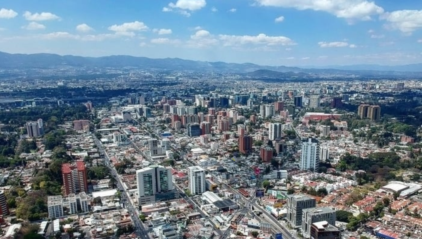
Known locally as “Guate” Guatemala City is the largest in city in Guatemala and has a very large population. More than 2.4 million people live within a 150 square mile radius of Guatemala City making it the most populated city in Guatemala. This is a must see if you are trying to experience what the culture is like in a Guatemalan city due to the amount of people and scale of markets. Guatemala is known as the transportation hub due to its location in the country and its dense population. Main modes of transportation in the city include public transportation shuttles and stagecoach busses.
2) San
Marcos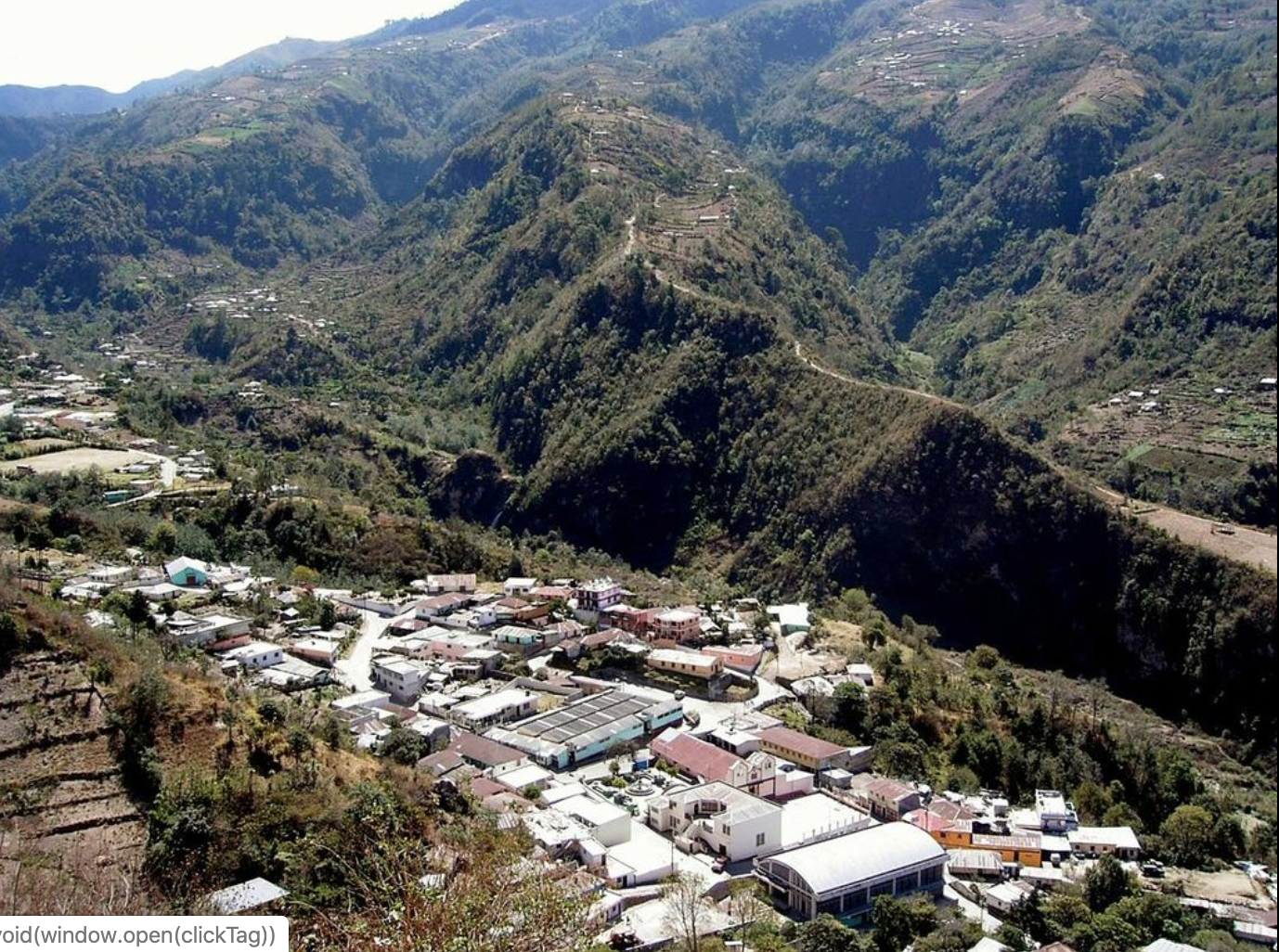
San Marcos is a city in the southwestern region of Guatemala and sits at an elevation of 7,700 feet above sea level. With a population of a little under 50,000 San Marcos acts as a marketplace for surrounding highland villages where crops such as coffee, maize (corn), wheat and other locally grown crops are sold. This is not only a small city that grows cash crops but also the surprising location of the professional football club Marquense which were founded in 1958.
3) Huehuetenango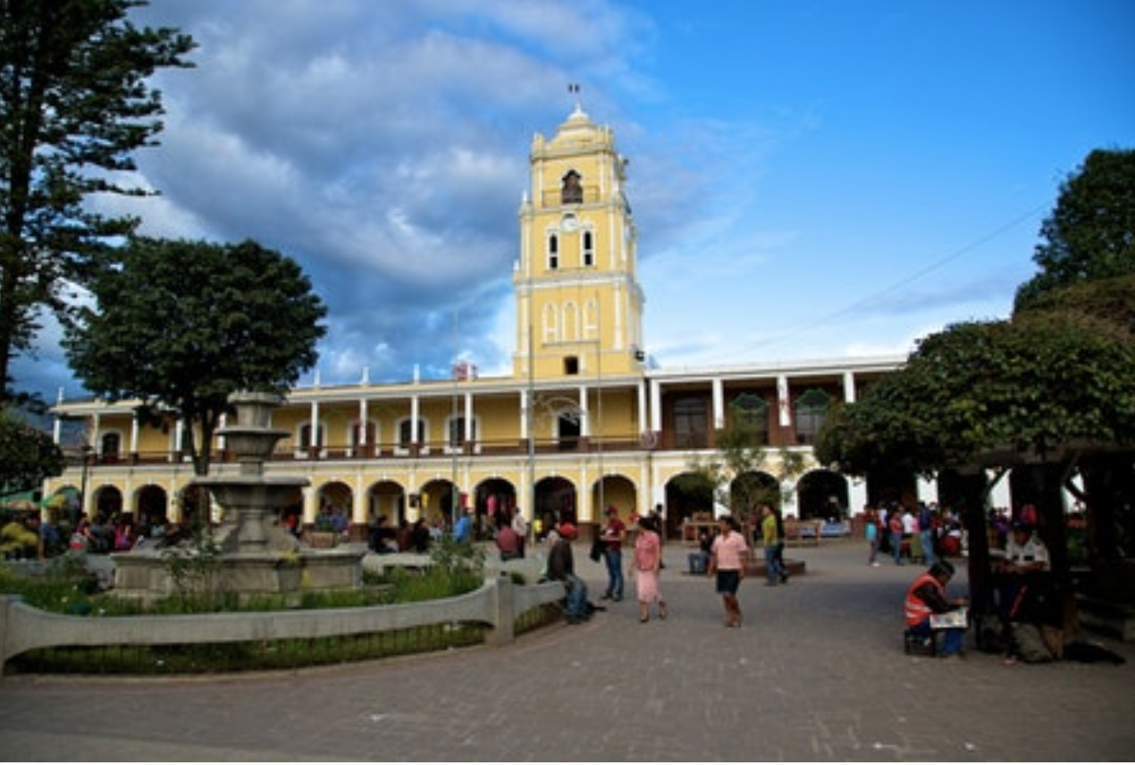
Huehuetenango is locally known as “huehue” and the city is surrounded by mountains and dense forestry. Like most cities in Guatemala Huehuetenango is populated with many farmers and traders looking to sell their goods. This region of Guatemala is also known as a pass by area for travelers trying to make it to Mexico but is never heavily populated with tourists. Huehuetenango has a subtropical highland climate with relatively dry winters and moderately wet summers. This is also the location of the top of the line soccer team also known as Halcones football club.
4) Coban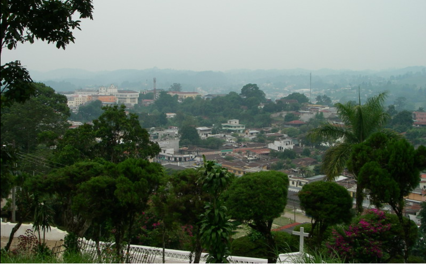
Coban is located in the Chama Mountains next to the Cahbon river in the northern region of Guatemala and sits at 4,331 feet above sea level. The city was named after the Indian chieftain Cobaou, and ancient structures still cover the land surrounding the city. There are Mayan ruins in the region surrounding the city and even a 17th century church which is still standing in the city today. This region is known for its historical monuments and high quality coffee beans.
3 Landmarks
1) Tikal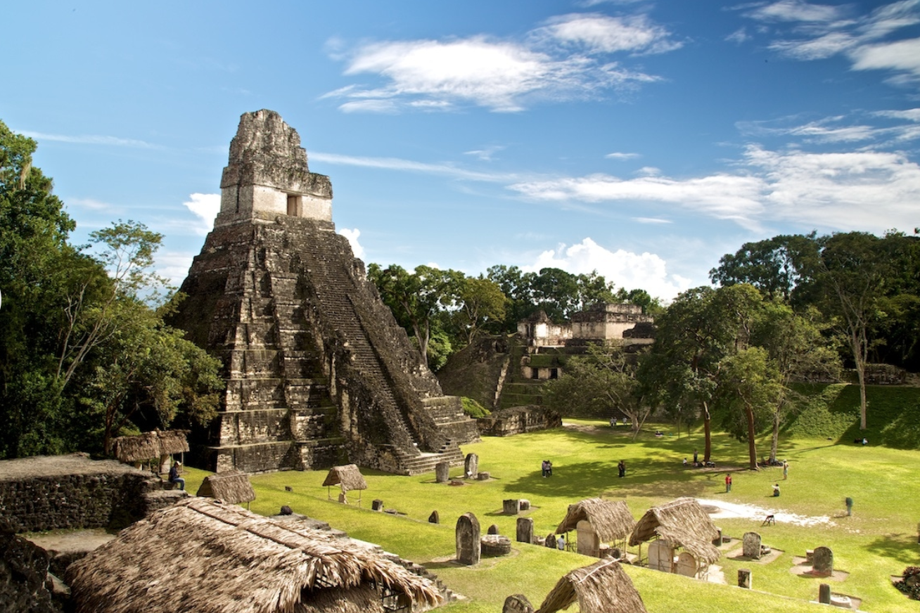
Located in the Northern region of Guatemala Tikal National Park is one of the largest archeological sites in the entire country enclosing around 600 sq. km. Tikal is best known for its incredibly well preserved Mayan cities and structures and is one of the most visited sites in Guatemala by tourists. Centered in the middle of the rain forest Tikal offers not only archeological beauties but natural ones as well for an all-around experience like no other. There are over 3,000 archeological cites in the park and the park itself belongs to the Maya Biosphere Reserve.
2) Antigua
Antigua is a city in Guatemala which is best known for its landscapes and cultural emersion. Located 1,500m above sea level Antigua’s landscape is best defined by lake Atitlan and the volcanoes in which surround it. Antigua truly makes for an experience like no other in an environment in which you can find only a few places in the world. Antigua is also known for its beautiful Spanish Baroque-influenced preserved buildings and street side markets located outside of them.
3) Pacaya
Volcano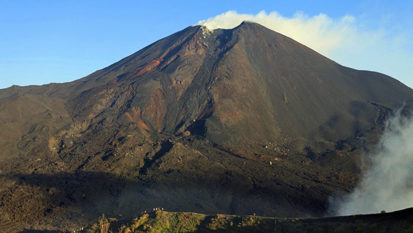
Pacaya is an active volcano that rises to an elevation of 8,373 feet and is located on the outskirts of Antigua. This tourist attraction has erupted almost 30 times since the 1550’s and as recent as March 2, 2014 and is still active to this day, yet tourists still climb the volcano. This volcanic region is easily accessible from both Guatemala City and Antigua which makes it one of the reasons it’s so frequently visited by tourists.
4) Quetzaltenango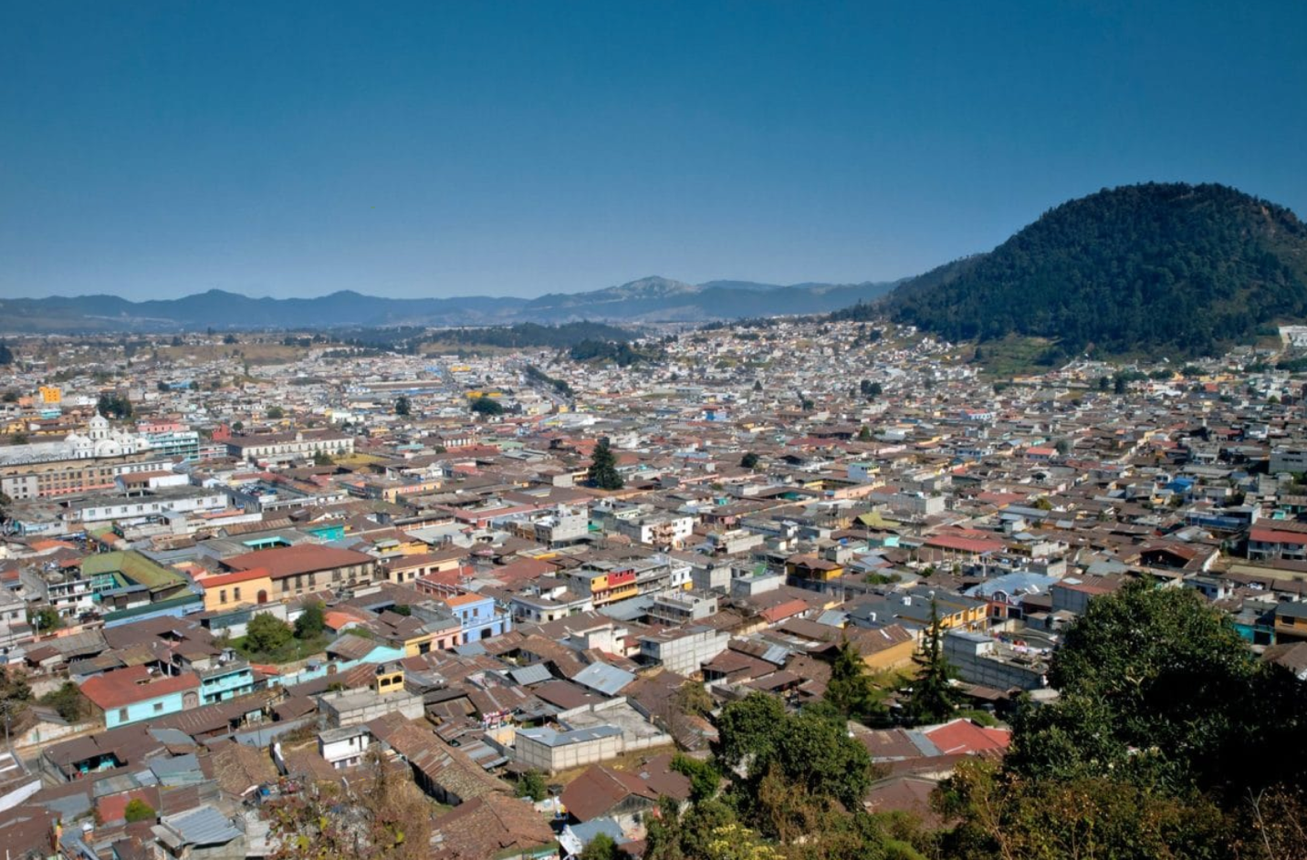
Quetzaltenango, known to some locals as Xela, is the second largest city in Guatemala and is well known for being a hub for commercial activities. This city is known for its beautiful buildings and close by mountain ranges. Quetzaltenango has a population of around 200,000 with around 61% of that population being indigenous. The subtropical highland climate of this region makes it a desirable destination any time of the year. This is also the home of the tallest peak in Guatemala volcano Tajumulco which attracts thrill seeking tourists.
4 Images of People
1) Mayan
Family 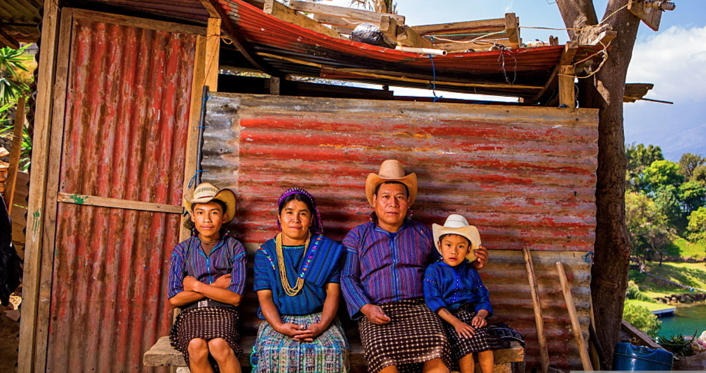
Most of the people of Guatemala who are indigenous come from a Mayan decent. This Mayan family is located just outside of lake Atitlan and are wearing traditional bright yarn clothes. The Mayan history in this region extends back five thousand years and many practices continue today. The Mayan people have not spread out much and have maintained the region of Central America dominated by their ancestors till this day. There are as many as twenty different Mayan communities in the country and are said to make up a large percentage of the overall population.
2) Elena
Bizarro 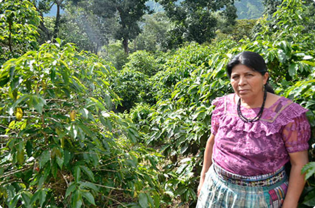
Like Elena Bizarro many people and families in Guatemala make a living by farming or engaging in some form of agriculture. Elena Bizarro is pictured above in her Coffee farm; coffee is one of the biggest cash crops in the region and many families are connected to the farms. With percent of people living in poverty in some regions of Guatemala reaching 70% many families across the country survive by providing their own food.
3) Sustenance
Farmer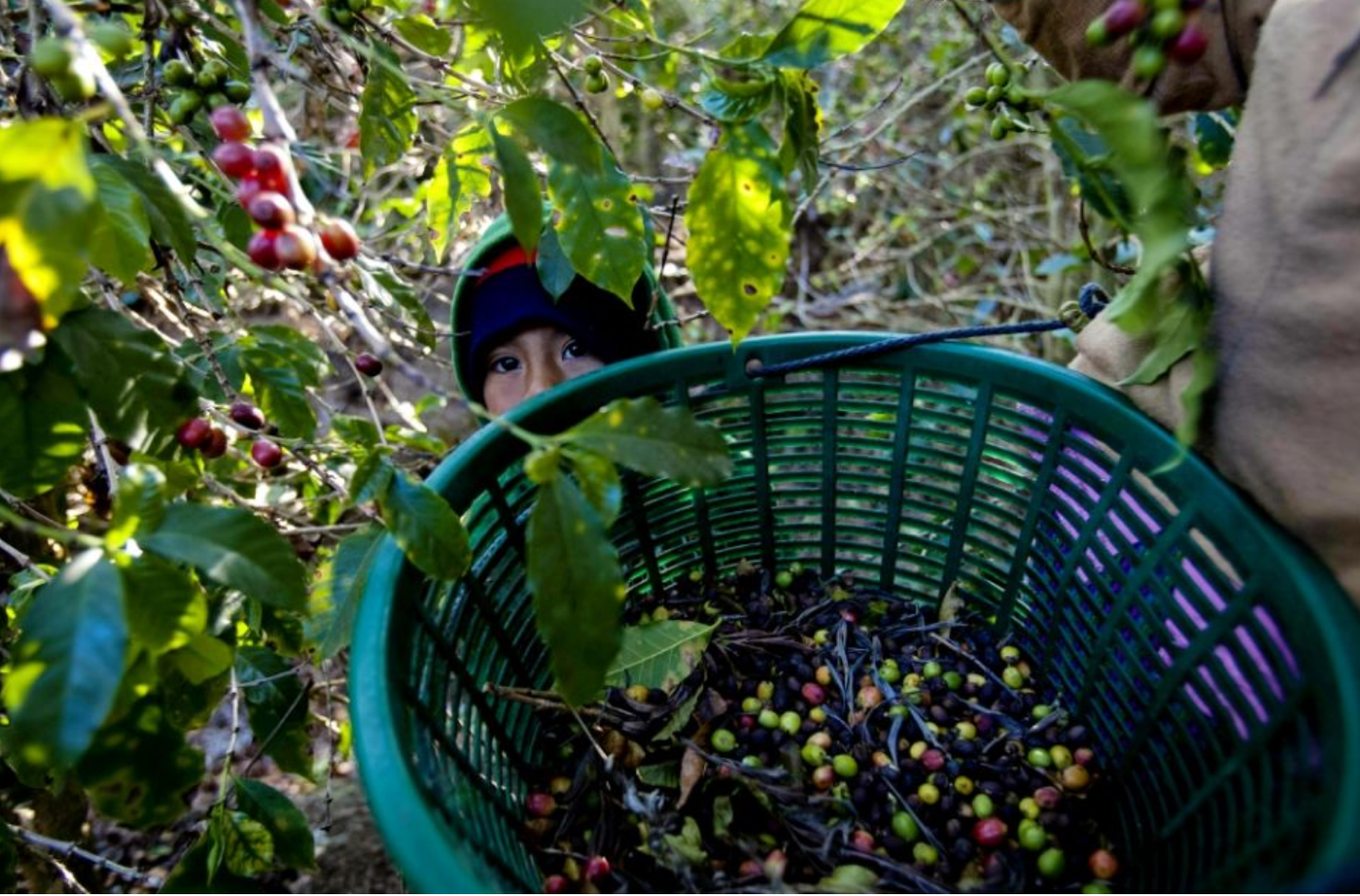
Guatemala is a country which is known for its vast inequality in wealth distribution and poverty. This in turn leaves a large number of the population in poverty and even larger numbers of indigenous people are being affected. Sustenance farmers are those who grow their own food to provide for their families and this is very common amongst the poorer communities of Guatemala. What we see above is one of these farmers collecting coffee beans either to sell or for personal consumption.
4) Antigua
Market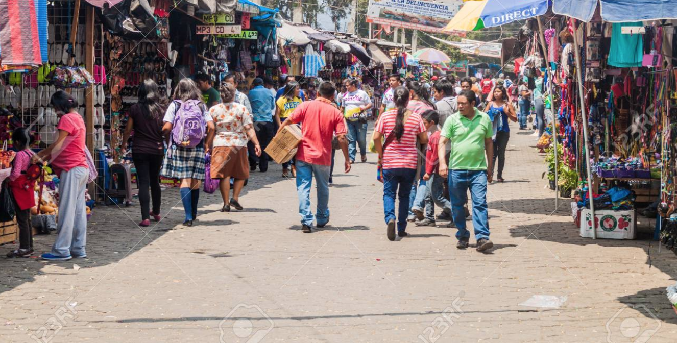
There are many different ways the people of Guatemala present themselves and dress. This likely depends on which region of the country you are in and what their ancestry is. As you can see from the image of the Antigua market there are many different styles of clothing people wear; not everyone is wearing elaborate dresses or outfits. This is also a tourist location and most likely is always a diverse crowd.
5 Images from the
Book
1) Todos
Santos Cuchumatan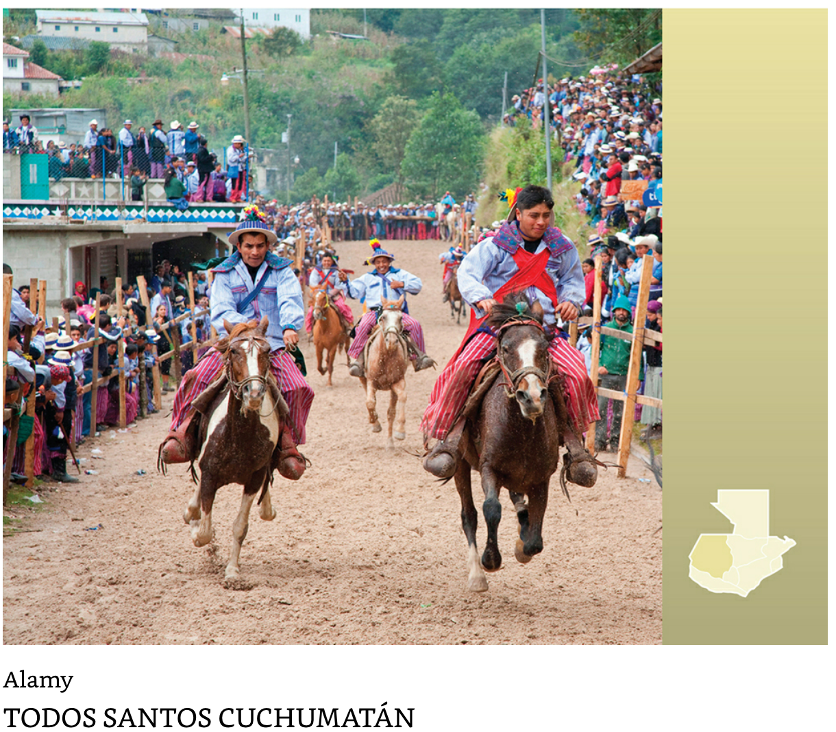
Todos Santos Cuchumatan is a town located in the western highlands of Huehuetenango which has remained isolated for many years. Due to this isolation of sorts the people here are still heavily involved in Mayan traditions. The People of Todos Santos still speak the ancient Mayan language called Mam and still dress in traditional clothes. This is one of the places in Guatemala which operate around their ancestry and offer something you can’t find in any other region of the world.
2) Antigua
Lent Processions 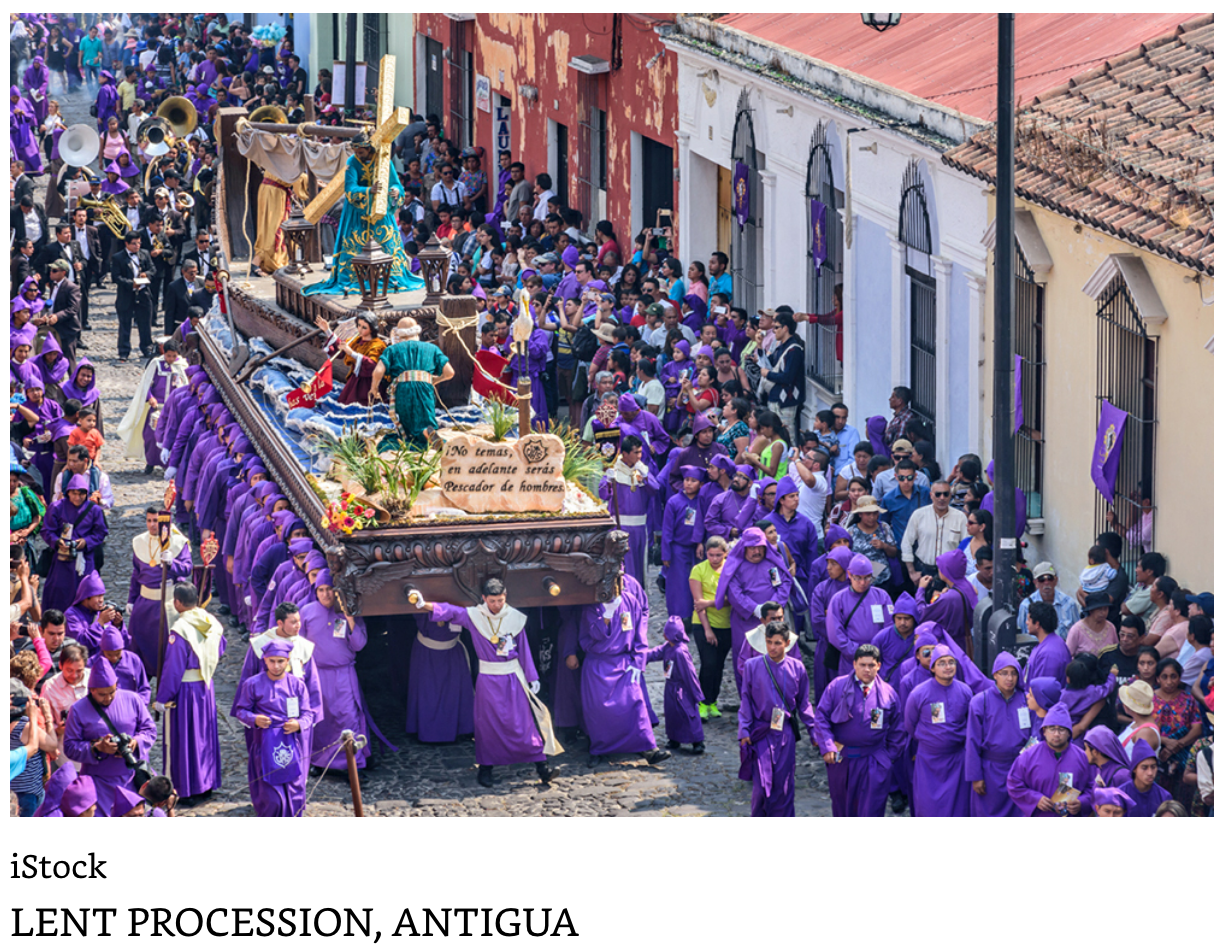
The people of Antigua are heavily influenced by culture and ancestry making this one of the most popular times to visit Antigua. During this six week period of the year following lent the people of Antiguan and from all over the world gather and immerse in cultural parades and processions. People gather all over the streets and even the roof tops to get a glance at this awesome event. This is the busiest time of the year for Antigua which is already one of the number one destination in Guatemala.
6 Webcam
1)Day and Night 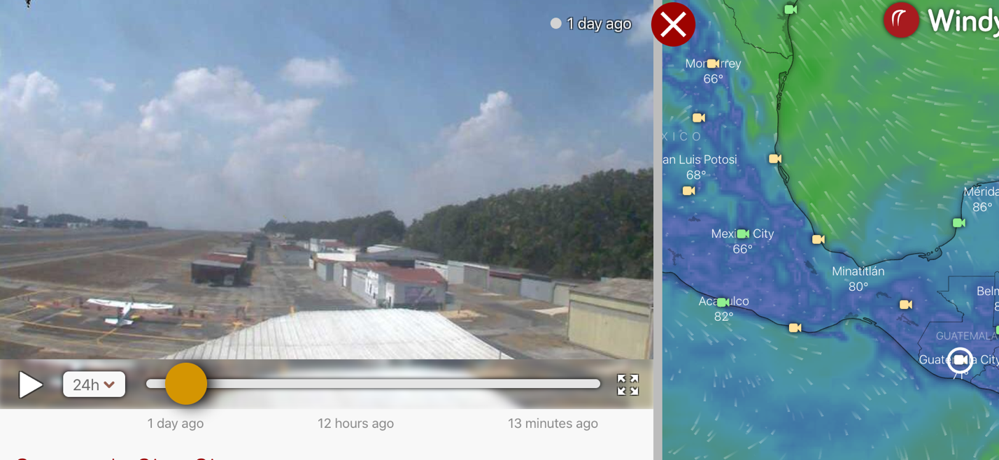
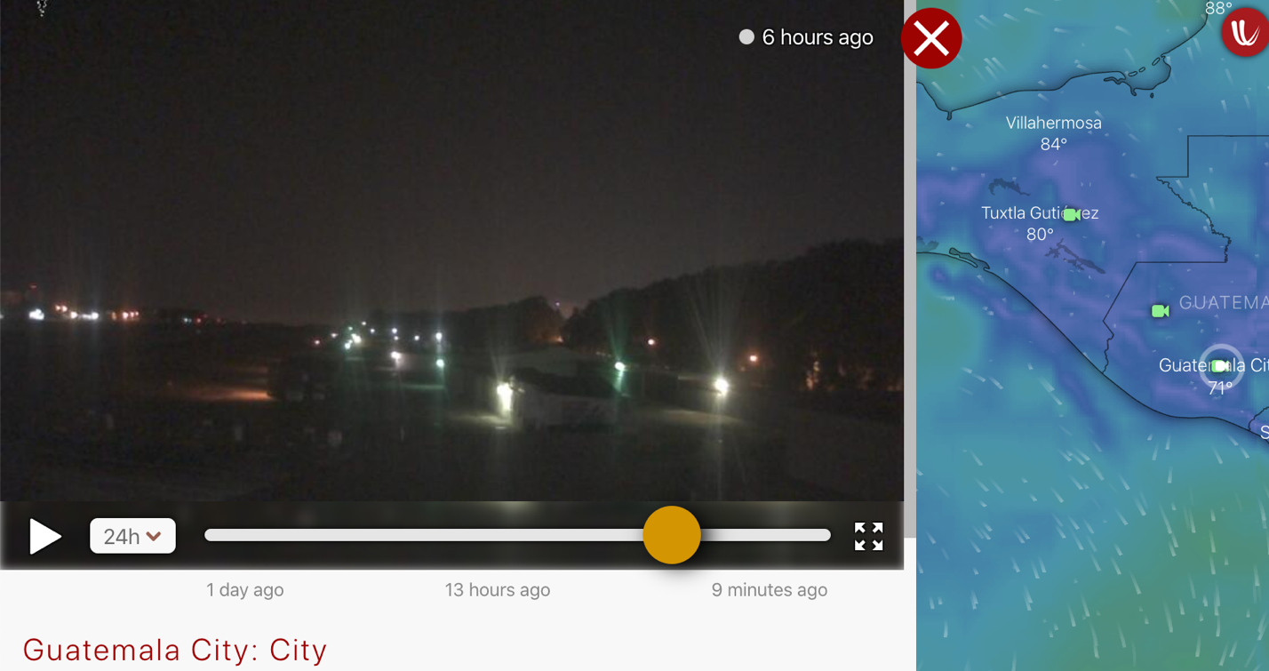
Guatemala City is the largest city in Guatemala and has multiple airports. There are also private airports in the surrounding areas of the city for all kinds of things mainly agriculture. Here is a webcam of a private airport just outside of Guatemala City which is also a place you can store a small plane. This webcam was free online and also offered other useful flight information such as wind speed and direction as well as future weather patterns. Above is a picture from day and nighttime from the same webcam.
7 Panorama
1) Lake
Atitlan 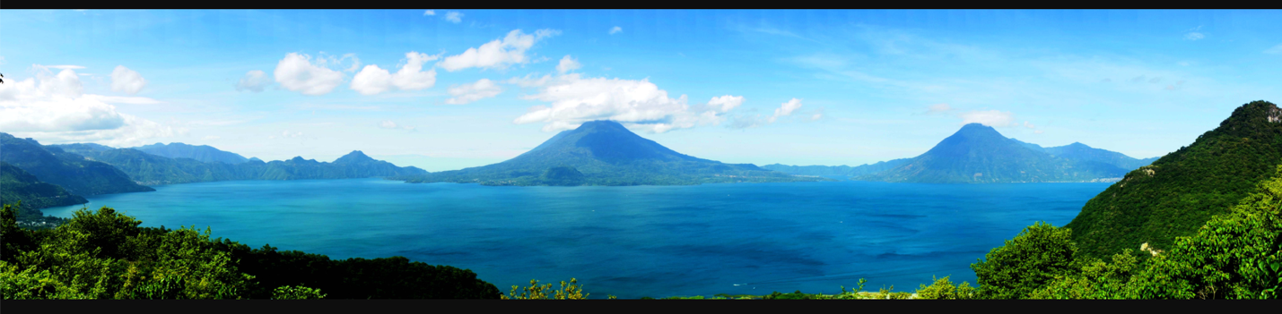
Lake Atitlan is one of the most well-known areas in Guatemala due to its landscape and natural beauty. As you can see in this Panorama of Lake Atitlan the scene encompasses the whole horizon. Surrounded by volcanos lake Atitlan is one of the most unique spots Guatemala has to offer with rainforests, volcanos and beautiful water all in one spot. Lake Atitlan has a max depth of about 1,120 feet and the surface level itself is 5,125 feet making it a crater of water in a volcanic crater.
Submitted
by Zach Boll on 4/3/2020.